
Voyageur Map 2 BWCA

$9.95
Available for In-Store Pick Up
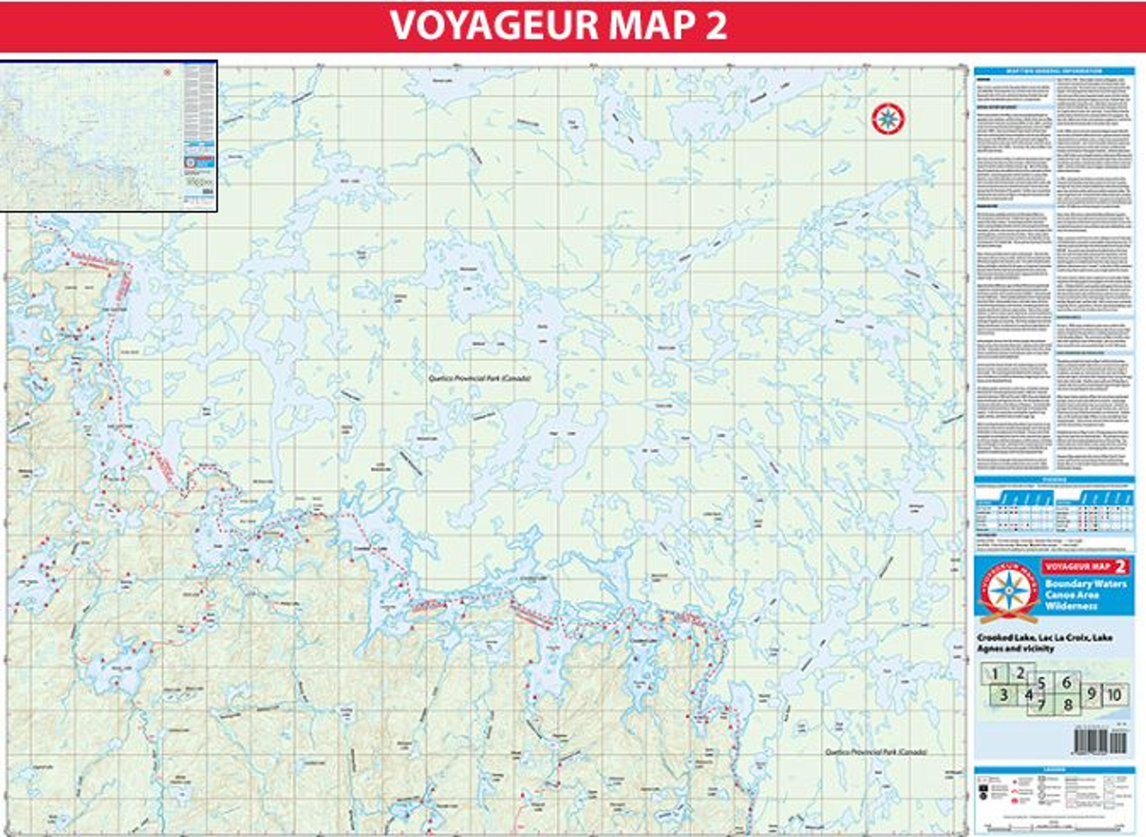
Map 2 covers a portion of the Boundary Waters Canoe Area Wilderness (BWCAW) stretching from Lac La Croix in the west almost to Basswood Lake in the east, primarily showing Crooked Lake and areas within the BWCAW south of the U.S.-Canada border.
The main corridor for canoe travel on Map 2 within the Boundary Waters is along the border lakes from Lac La Croix to Iron Lake, through Crooked Lake and then on to Basswood Lake (shown on Map 5). In addition, portages are maintained on the west side of Map 2 around Lake Agnes, the Stuart River, Dahlgren River and up through Rush Lake to Iron Lake.
Another route south out of Friday Bay in Crooked Lake also contains maintained portages through Papoose Lake down through Wagosh Lake and beyond.
Other large interior sections of Map 2 do not contain maintained portages and are much more difficult to traverse. No portages between Stuart and Sunday Lakes are maintained. Similarly, no portages from Beartrap Lake, up through Sunday Lake, and on to Parley Lake by way of the Beartrap River are maintained. Jackfish Lake, on the south east edge of Map 2, is not accessible by maintained portages. These interior areas lie within the Sundial Lake and Tick Lake primitive management areas.