
Voyageur Map 3 BWCA

$9.95
Available for In-Store Pick Up
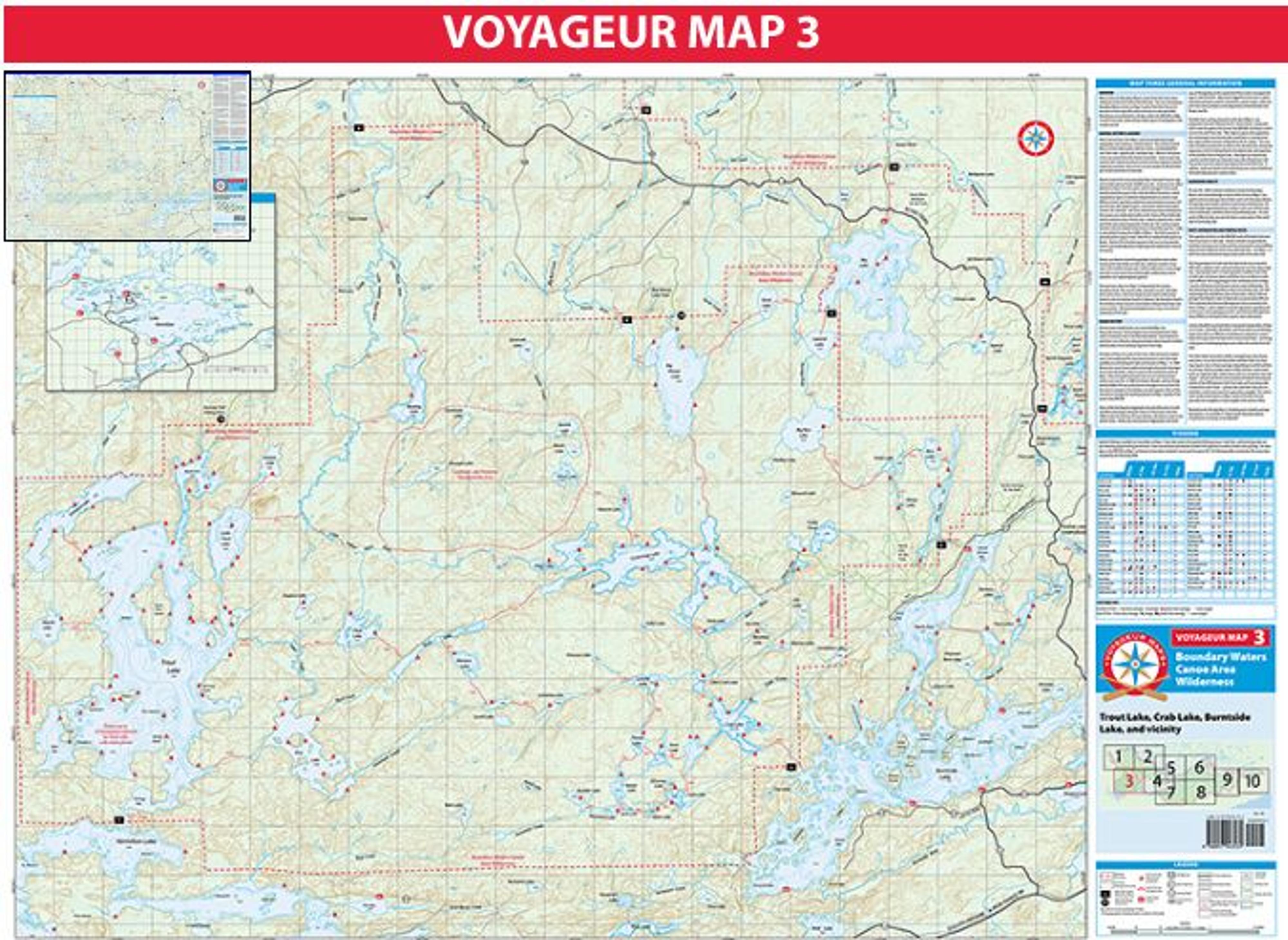
Map 3 covers the Boundary Waters south of the Echo Trail, plus a small part of the area north of the Echo Trail. The two most popular Boundary Waters entries on Map 3 south of the Echo Trail are in the west at Trout Lake (EP1) and in the east at Crab Lake (EP4). Motorboats are prohibited on all lakes within the BWCAW on Map 3 except Trout Lake, which allows motors up to 25 horsepower with a proper permit.
The majority of visitors to the BWCAW south of the Echo Trail enter from Trout Lake or Crab Lake. Greater solitude can generally be found by starting at one of the northern entry points or by paddling deep into the wilderness from Trout and Crab Lakes. See Maps 1, 2, and 4 for more information about areas north of the Echo Trail.
The long portage into Crab Lake from Burntside was rerouted in 2003 after a dispute with a private landowner over the old portage trail. During high water it may be possible to paddle Crab Creek to Crab Lake, but beaver dams and fallen trees are likely to make travel difficult. The long portages in the northeast corner of Map 3 receive infrequent maintenance and are quite challenging.
Caution should be exercised when crossing the largest lakes of Map 3 in a canoe. Burntside, Vermillion, and Trout Lakes can all develop large waves that are difficult or hazardous to navigate in a canoe. Early morning is often the best time to cross these lakes. Cummings is also prone to developing large waves when the wind is from the west.